This is the latest update on the 25 Mile Fire from the USFS as of Monday morning, Sept. 13.
Fire Information Line:
509-761-9217
(Daily from 8 a.m. to 8 p.m.)
Size: 21,373 acres
Total Personnel: 352
Containment: 50%
Location: 12 miles
NW of Chelan,
Cause: Under investigation
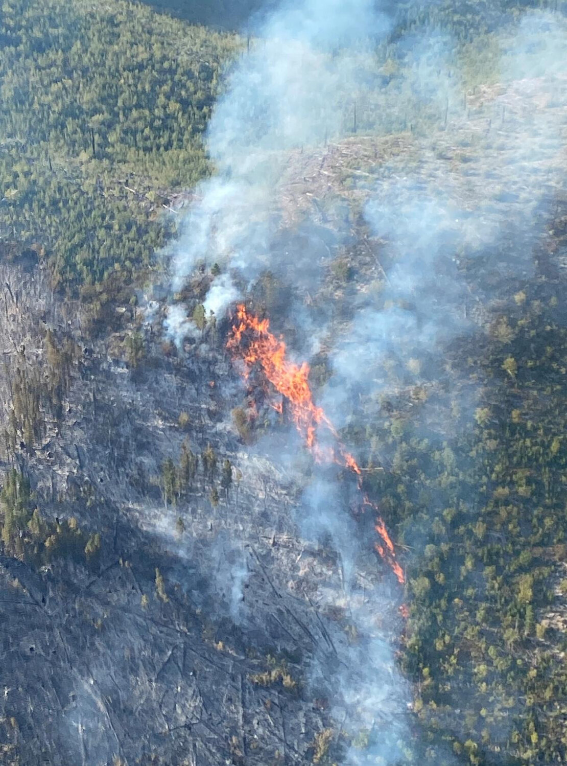
Yesterday (Sept. 12): With sunshine and increased winds drying out fuels following recent rainfall, burnout operations were successfully resumed Sunday afternoon. Favorable winds helped firefighters gain up to 300 feet of depth along the fire line on Devils Backbone toward Stormy Mountain. The fire burned actively in pockets of unburned vegetation that were well within the perimeter in the Twenty-five Mile Creek drainage and the tributary to the north. Early in the evening, a large root wad flared up near the fireline, requiring five helicopter bucket loads of water to fully saturate it and ensure it could not ignite spot fires by rolling outside the line. Monitoring continued on the inactive eastern edge, while firefighters worked to break-down and remove hoselays and equipment from the north and northwestern sections to return and refurbish it for use on other fires.
Today (Sept. 13): Work will continue to connect and strengthen fireline northward along the Devils Backbone toward Angle Peak. Aerial ignitions will involve the use of a helicopter mounted plastic sphere dispenser (PSD) that distributes spheres about the shape and size of ping pong balls. The plastic spheres contain potassium permanganate and are injected with ethylene glycol (antifreeze). A chemical reaction causes the sphere to ignite approximately 20 to 30 seconds after injection. A short video describing PSD use is available at www.youtube.com/watch?v=3iPNOw-oQgo.
Use of aerial ignition helps to limit firefighter exposure to risk in this steep and rocky area by reducing time needed to burn. As vegetation becomes more sparse along the northwest edge, firefighters continue to assess options to solidify the fire’s edge before fall weather patterns begin to limit options. Meanwhile, on the fire’s northwest and northern perimeter, firefighters continue work to mop up, chip, and remove hoses, pumps, and other equipment that is no longer needed to contain the fire in that area.
Weather and Fire Behavior: Lighter winds and sunshine, along with slightly lower relative humidity, is forecasted today. Winds are expected to slowly move fire along in alignment with area landscape features, with an easterly flow in the morning shifting to west/southwest in the early afternoon wind speeds of 5 to 10 ridgetops.
Evacuations: Level 1 (Be Ready): All properties along South Lakeshore Road (from just north of Lake Chelan State Park to the end of the roadway), First Creek Road and Granite Falls Road. A map of current evacuation levels is available at: bit.ly/2WhU9Nu and additional information is available from Chelan County Emergency Management (facebook.com/ccsoem/).
Closures: The Okanogan-Wenatchee National Forest expanded the emergency fire closure in place for the Twenty-five Mile Fire earlier this week. Please check the interactive map of emergency closures when planning an outing: tinyurl.com/25mileforest
Fire Information Center: 509-761-9217 #TwentyfiveMileFire
Pacific Northwest Team 3


Comments
No comments on this item Please log in to comment by clicking here